Geolocate

Medewi topographic map

Click on the map to display elevation.

About this map

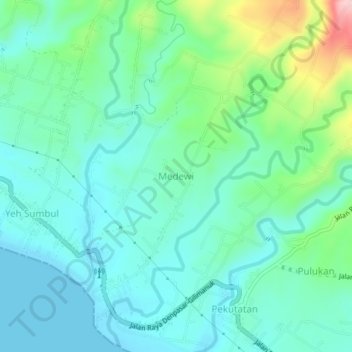
Name: Medewi topographic map, elevation, terrain.

Location: Medewi, Jembrana, Bali, Indonesia (-8.42307 114.79450 -8.38307 114.83450)

Average elevation: 49 m

Minimum elevation: 0 m

Maximum elevation: 214 m

Gear up for your next adventure:

🧶550 Survival Paracord - Versatile utility cord for emergency repairs and rigging
Family Camping Tent - Spacious tent suitable for family camping trips
💧Hydration Bladder - Hands-free hydration solution for long treks
🔨Vehicle Emergency Tool - Safety tool for remote road trips to trailheads
🥾Light Trekking Boots - Supportive boots for multi-day treks

As an Amazon Associate, this site earns from qualifying purchases at no extra cost to you.