Geolocate

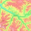
Woincourt topographic map

Click on the map to display elevation.

About this map

Name: Woincourt topographic map, elevation, terrain.

Location: Woincourt, Abbeville, Somme, Hauts-de-France, Metropolitan France, 80520, France (50.04958 1.52650 50.07531 1.55949)

Average elevation: 110 m

Minimum elevation: 78 m

Maximum elevation: 130 m

Other topographic maps

Click on a map to view its topography, its elevation and its terrain.

Petit-Camon

France > Hauts-de-France > Somme > Camon

Average elevation: 73 m

Amiens

France > Hauts-de-France > Somme > Amiens

Average elevation: 86 m

Larronville

France > Hauts-de-France > Somme > Rue

Average elevation: 8 m

Gear up for your next adventure:

🛌Down Sleeping Bag - Superior warmth-to-weight ratio for cold nights
🧢Sun Protection Cap - Breathable cap to protect from sun exposure
🛶Canoe Life Vest - Safety vest for water sports
🛌Insulated Sleeping Pad - Critical thermal barrier between you and the cold ground
🧴Waterproofing Spray - Restore the DWR coating on jackets and tents

As an Amazon Associate, this site earns from qualifying purchases at no extra cost to you.