Geolocate

Neckargemünd topographic map

Click on the map to display elevation.

About this map
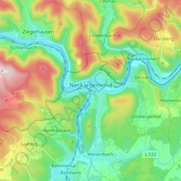
Name: Neckargemünd topographic map, elevation, terrain.

Location: Neckargemünd, GVV Neckargemünd, Rhein-Neckar-Kreis, Baden-Württemberg, 69151, Germany (49.36873 8.75472 49.41624 8.89119)

Average elevation: 247 m

Minimum elevation: 106 m

Maximum elevation: 481 m

Other topographic maps

Click on a map to view its topography, its elevation and its terrain.

Gear up for your next adventure:

🧊Insulated Water Bottle - Keeps drinks cold in summer and prevents freezing in winter
🏃Hydration Running Vest - Carry water and maps close to your body for speed
🥾Hiking Gaiters - Protect legs and shoes from mud, snow, and debris
🧢Outdoor Visor - Breathable visor for sunny hikes
🥾Durable Hiking Shoes - Long-lasting shoes for frequent hiking

As an Amazon Associate, this site earns from qualifying purchases at no extra cost to you.