Geolocate

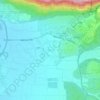
Oshrat topographic map

Click on the map to display elevation.

About this map

Name: Oshrat topographic map, elevation, terrain.

Location: Oshrat, Mate Asher Regional Council, Acre Subdistrict, North District, Israel (32.96913 35.15281 32.97466 35.16167)

Average elevation: 60 m

Minimum elevation: 21 m

Maximum elevation: 128 m

Other topographic maps

Click on a map to view its topography, its elevation and its terrain.
Gear up for your next adventure:

🥾Durable Hiking Shoes - Long-lasting shoes for frequent hiking
🧢Sun Hat - Wide-brim hat for sun protection
💧Reusable Water Bottle - Durable water bottles for hydration on trails
🔋Solar Power Bank - Keep your GPS and devices charged during long outdoor trips
👟Leg Gaiters - Keep debris, mud, and snow out of your boots

As an Amazon Associate, this site earns from qualifying purchases at no extra cost to you.