
Thank you for supporting this site ❤️
Make a donation
Make a donation
Gear up for your next adventure:
As an Amazon Associate, this site earns from qualifying purchases at no extra cost to you.
Prutz topographic map
Click on the map to display elevation.
Thank you for supporting this site ❤️
Make a donation
Make a donation
Gear up for your next adventure:
As an Amazon Associate, this site earns from qualifying purchases at no extra cost to you.
About this map
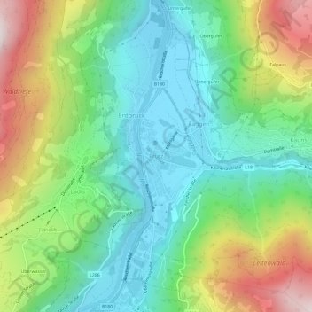
Name: Prutz topographic map, elevation, terrain.
Location: Prutz, Gemeinde Prutz, Bezirk Landeck, Tirol, 6522, Österreich (47.05706 10.64426 47.09706 10.68426)
Average elevation: 1,197 m
Minimum elevation: 857 m
Maximum elevation: 1,876 m
Thank you for supporting this site ❤️
Make a donation
Make a donation
Gear up for your next adventure:
As an Amazon Associate, this site earns from qualifying purchases at no extra cost to you.