Geolocate

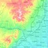
Shizhuangcun topographic map

Click on the map to display elevation.

About this map

Name: Shizhuangcun topographic map, elevation, terrain.

Location: Shizhuangcun, Datong City, Shanxi, China (40.01856 113.19319 40.05856 113.23319)

Average elevation: 1,049 m

Minimum elevation: 1,036 m

Maximum elevation: 1,089 m

Other topographic maps

Click on a map to view its topography, its elevation and its terrain.

Yungang District

China > Shanxi > Datong City

Average elevation: 1,186 m

Yungang Grottoes

China > Shanxi > Datong City > Yungang

Average elevation: 1,164 m

Guangling County

China > Shanxi > Datong City

Average elevation: 1,424 m

Yungang

China > Shanxi > Datong City

Average elevation: 1,189 m

Gear up for your next adventure:

🪑Ultralight Camping Stool - Compact seating for rest stops during long hikes
🐕Hiking Dog Pack - Let your canine companion carry their own water and food
🧣Merino Neck Gaiter - Protects against wind, sun, and cold at high altitudes
🛁Quick-Dry Microfiber Towel - Space-saving towel that dries rapidly on the move
🧰Multitool Knife - Compact and versatile tool for outdoor use

As an Amazon Associate, this site earns from qualifying purchases at no extra cost to you.