
Thank you for supporting this site ❤️
Make a donation
Make a donation
Gear up for your next adventure:
As an Amazon Associate, this site earns from qualifying purchases at no extra cost to you.
Mariquina topographic map
Click on the map to display elevation.
Thank you for supporting this site ❤️
Make a donation
Make a donation
Gear up for your next adventure:
As an Amazon Associate, this site earns from qualifying purchases at no extra cost to you.
About this map
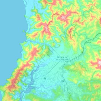
Name: Mariquina topographic map, elevation, terrain.
Location: Mariquina, Provincia de Valdivia, Los Ríos Region, Chile (-39.70706 -73.32401 -39.28735 -72.60130)
Average elevation: 135 m
Minimum elevation: -2 m
Maximum elevation: 851 m
Thank you for supporting this site ❤️
Make a donation
Make a donation
Gear up for your next adventure:
As an Amazon Associate, this site earns from qualifying purchases at no extra cost to you.
Other topographic maps
Click on a map to view its topography, its elevation and its terrain.
San José de La Mariquina
Chile > Los Ríos Region > Provincia de Valdivia > Mariquina
Average elevation: 32 m