Geolocate

Karangmalang topographic map

Click on the map to display elevation.

About this map

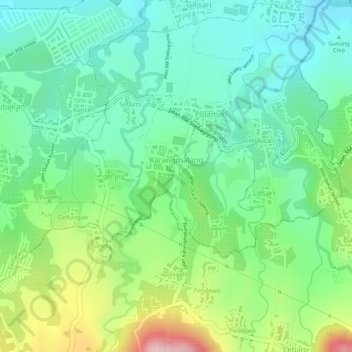
Name: Karangmalang topographic map, elevation, terrain.

Location: Karangmalang, Mijen, Semarang, Central Java, Java, Indonesia (-7.10414 110.32301 -7.09159 110.34548)

Average elevation: 307 m

Minimum elevation: 227 m

Maximum elevation: 460 m

Other topographic maps

Click on a map to view its topography, its elevation and its terrain.

Kramas

Indonesia > Central Java > Semarang

Average elevation: 170 m

Ngaliyan

Indonesia > Central Java > Semarang

Average elevation: 125 m

Gajahmungkur

Indonesia > Central Java > Semarang

Average elevation: 64 m

Tembalang

Indonesia > Central Java > Semarang > Bulusan

Average elevation: 194 m

Ampelgading

Indonesia > Central Java > Semarang

Average elevation: 196 m

Tikung

Indonesia > Central Java > Semarang

Average elevation: 22 m

Candisari

Indonesia > Central Java > Semarang

Average elevation: 126 m

Tambakaji

Indonesia > Central Java > Semarang

Average elevation: 60 m

Gunungpati

Indonesia > Central Java > Semarang

Average elevation: 303 m

Gear up for your next adventure:

👖Convertible Hiking Pants - Zip-off legs to adapt to changing weather conditions
🧭GPS Outdoor Watch - Smart watch for navigation and fitness tracking in nature
🗺️Topographic Maps - Detailed maps to explore trails, mountains, and wilderness areas
Family Camping Tent - Spacious tent suitable for family camping trips
🥾Hiking Leggings - Comfortable leggings for outdoor activities

As an Amazon Associate, this site earns from qualifying purchases at no extra cost to you.