Geolocate

Pong Dam topographic map

Click on the map to display elevation.

About this map

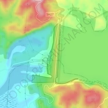
Name: Pong Dam topographic map, elevation, terrain.

Location: Pong Dam, Fatehpur, Kangra District, Himachal Pradesh, India (31.96330 75.93934 31.97857 75.95292)

Average elevation: 406 m

Minimum elevation: 329 m

Maximum elevation: 527 m

Gear up for your next adventure:

💡Solar Camping Lamp - Eco-friendly lighting for campsites
🎒Backpack Rain Cover - External shield to keep your entire pack dry
🔥Camping Stove - Portable stoves to cook outdoors with ease
🧥Softshell Hiking Jacket - The perfect balance of wind protection and breathability
🔪Outdoor Multitool - Versatile tool for repairs and food prep in the wild

As an Amazon Associate, this site earns from qualifying purchases at no extra cost to you.