
Whitefish topographic map
Click on the map to display elevation.
About this map
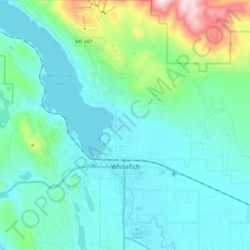
Name: Whitefish topographic map, elevation, terrain.
Location: Whitefish, Flathead County, Montana, 59937, United States (48.37273 -114.43311 48.48640 -114.30771)
Average elevation: 1,075 m
Minimum elevation: 902 m
Maximum elevation: 1,947 m
Other topographic maps
Click on a map to view its topography, its elevation and its terrain.