
Thank you for supporting this site ❤️
Make a donation
Make a donation
Gear up for your next adventure:
As an Amazon Associate, this site earns from qualifying purchases at no extra cost to you.
Vilarmayor topographic map
Click on the map to display elevation.
Thank you for supporting this site ❤️
Make a donation
Make a donation
Gear up for your next adventure:
As an Amazon Associate, this site earns from qualifying purchases at no extra cost to you.
About this map
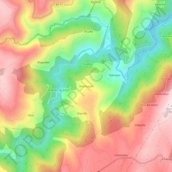
Name: Vilarmayor topographic map, elevation, terrain.
Location: Vilarmayor, Grandas de Salime, Asturias, 33730, España (43.20821 -6.93440 43.24821 -6.89440)
Average elevation: 459 m
Minimum elevation: 167 m
Maximum elevation: 746 m
Thank you for supporting this site ❤️
Make a donation
Make a donation
Gear up for your next adventure:
As an Amazon Associate, this site earns from qualifying purchases at no extra cost to you.