Geolocate

Turbo topographic map

Click on the map to display elevation.

About this map

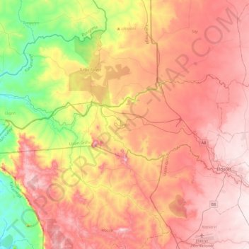
Name: Turbo topographic map, elevation, terrain.

Location: Turbo, Uasin Gishu County, Rift Valley, Kenya (0.51144 34.85349 0.68366 35.28686)

Average elevation: 1,908 m

Minimum elevation: 1,563 m

Maximum elevation: 2,184 m

Gear up for your next adventure:

🥾Hiking Shorts - Breathable shorts suitable for summer hikes
Lightweight Backpacking Tent - Compact tent for efficient hiking trips
🧥Ultralight Puffy Jacket - Maximum warmth that packs down to the size of an orange
🧭GPS Handheld Device - Reliable GPS navigation for outdoor adventures
🚲MTB Frame Bag - Carry tools and maps directly on your bicycle frame

As an Amazon Associate, this site earns from qualifying purchases at no extra cost to you.