Geolocate

Chakan topographic map

Click on the map to display elevation.

About this map

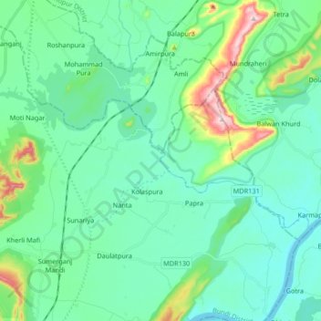
Name: Chakan topographic map, elevation, terrain.

Location: Chakan, Uniara Tehsil, Tonk District, Rajasthan, India (25.74599 76.19618 25.81029 76.36115)

Average elevation: 248 m

Minimum elevation: 189 m

Maximum elevation: 489 m

Gear up for your next adventure:

🦶Anti-Blister Balm - Prevents friction and hotspots during long ascents
🔦LED Flashlight - Powerful and long-lasting flashlight for camping and emergencies
🔋Lithium AA Batteries - Long-lasting power that performs in extreme cold
🛰️Satellite Messenger - Emergency communication for areas with no cell service
🗺️Topographic Maps - Detailed maps to explore trails, mountains, and wilderness areas

As an Amazon Associate, this site earns from qualifying purchases at no extra cost to you.