Geolocate

Heli topographic map

Click on the map to display elevation.

About this map

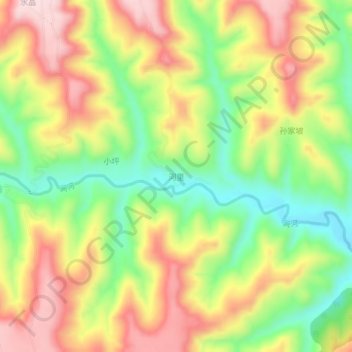
Name: Heli topographic map, elevation, terrain.

Location: Heli, Lingtai County, Pingliang, Gansu, China (35.07620 107.38100 35.11620 107.42100)

Average elevation: 1,239 m

Minimum elevation: 1,087 m

Maximum elevation: 1,396 m

Gear up for your next adventure:

🧥Waterproof Jacket - Lightweight rain jackets for hiking and outdoor activities
🦯Trekking Poles - Reduced impact on joints for steep topographic climbs
🥾Mountain Hiking Shoes - Shoes with superior grip for mountainous terrain
🧭GPS Outdoor Watch - Smart watch for navigation and fitness tracking in nature
🦟Insect Repellent - Keep mosquitoes and black flies away in wooded areas

As an Amazon Associate, this site earns from qualifying purchases at no extra cost to you.