
Thank you for supporting this site ❤️
Make a donation
Make a donation
Gear up for your next adventure:
As an Amazon Associate, this site earns from qualifying purchases at no extra cost to you.
Alamedilla topographic map
Click on the map to display elevation.
Thank you for supporting this site ❤️
Make a donation
Make a donation
Gear up for your next adventure:
As an Amazon Associate, this site earns from qualifying purchases at no extra cost to you.
About this map
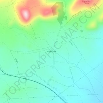
Name: Alamedilla topographic map, elevation, terrain.
Location: Alamedilla, Estepa, Séville, Andalousie, 41564, Espagne (37.20355 -4.85854 37.24355 -4.81854)
Average elevation: 516 m
Minimum elevation: 427 m
Maximum elevation: 779 m
Thank you for supporting this site ❤️
Make a donation
Make a donation
Gear up for your next adventure:
As an Amazon Associate, this site earns from qualifying purchases at no extra cost to you.