Geolocate

Dumas topographic map

Click on the map to display elevation.

About this map

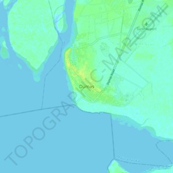
Name: Dumas topographic map, elevation, terrain.

Location: Dumas, Majura Taluka, Surat, Gujarat, 394320, India (21.04788 72.67256 21.12788 72.75256)

Average elevation: 3 m

Minimum elevation: -2 m

Maximum elevation: 14 m

Gear up for your next adventure:

🧤Thermal Hiking Gloves - Grip-enhanced gloves for cold-weather altitude trekking
🧴Sunscreen SPF - Broad-spectrum sunscreen for outdoor activities
👟Leg Gaiters - Keep debris, mud, and snow out of your boots
🔨Vehicle Emergency Tool - Safety tool for remote road trips to trailheads
👟Sport Hiking Sandals - Breathable footwear for water crossings and camp rest

As an Amazon Associate, this site earns from qualifying purchases at no extra cost to you.