Geolocate

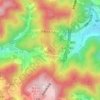
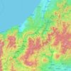
Fukuroi topographic map

Click on the map to display elevation.

About this map

Name: Fukuroi topographic map, elevation, terrain.

Location: Fukuroi, Shizuoka Prefecture, Chubu Region, Japan (34.51909 137.85125 34.82236 138.00967)

Average elevation: 19 m

Minimum elevation: -4 m

Maximum elevation: 263 m

Other topographic maps

Click on a map to view its topography, its elevation and its terrain.
Osaka Prefecture

Japan

Average elevation: 188 m

300M

Japan > Nagasaki

Average elevation: 220 m

Akaishi Mountains

Japan > Oshika

Average elevation: 2,591 m

Iwo to

Japan > Tokyo > Ogasawara

Average elevation: 0 m

Takeda Castle

Japan > Asago

Average elevation: 174 m

葭町

Japan > Matsumoto

Average elevation: 616 m

Nishikigaoka-chuo Park

Japan > Sendai

Average elevation: 197 m

Nakauonuma County

Japan

Average elevation: 605 m

Mount Yatsugatake viewpoint

Japan > Suwa County > Fujimi

Average elevation: 1,742 m

Gear up for your next adventure:

🗺️Topographic Maps - Detailed maps to explore trails, mountains, and wilderness areas
🕯️Camping Lantern - Illuminates your entire campsite with high-efficiency LEDs
🧦Hiking Liner Socks - Thin base layer to prevent friction and blisters
🥾Trail Hiking Shoes - Durable shoes designed for rugged trails
🧥Waterproof Hiking Jacket - Protect yourself from rain and wind while hiking

As an Amazon Associate, this site earns from qualifying purchases at no extra cost to you.