Geolocate

Florida topographic map

Click on the map to display elevation.

About this map

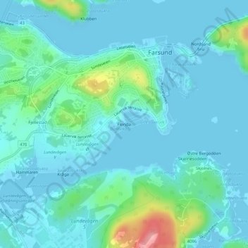
Name: Florida topographic map, elevation, terrain.

Location: Florida, Farsund, Agder, 4550, Norway (58.08723 6.79727 58.08733 6.79737)

Average elevation: 19 m

Minimum elevation: -1 m

Maximum elevation: 122 m

Gear up for your next adventure:

🧦Hiking Socks - Moisture-wicking and comfortable socks for long hikes
🕶️Polarized Sunglasses - Protect your eyes with durable polarized lenses
🧥Ultralight Puffy Jacket - Maximum warmth that packs down to the size of an orange
🗺️Topographic Maps - Detailed maps to explore trails, mountains, and wilderness areas
💡Compact LED Flashlight - Powerful and portable flashlight for outdoor use

As an Amazon Associate, this site earns from qualifying purchases at no extra cost to you.