
Thank you for supporting this site ❤️
Make a donation
Make a donation
Gear up for your next adventure:
As an Amazon Associate, this site earns from qualifying purchases at no extra cost to you.
Ruvari I topographic map
Click on the map to display elevation.
Thank you for supporting this site ❤️
Make a donation
Make a donation
Gear up for your next adventure:
As an Amazon Associate, this site earns from qualifying purchases at no extra cost to you.
About this map
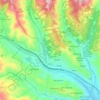
Name: Ruvari I topographic map, elevation, terrain.
Location: Ruvari I, Grotteria, Reggio Calabria, 89042, Italia (38.33129 16.24151 38.37129 16.28151)
Average elevation: 239 m
Minimum elevation: 82 m
Maximum elevation: 498 m
Thank you for supporting this site ❤️
Make a donation
Make a donation
Gear up for your next adventure:
As an Amazon Associate, this site earns from qualifying purchases at no extra cost to you.