
Thank you for supporting this site ❤️
Make a donation
Make a donation
Gear up for your next adventure:
As an Amazon Associate, this site earns from qualifying purchases at no extra cost to you.
Girimarto topographic map
Click on the map to display elevation.
Thank you for supporting this site ❤️
Make a donation
Make a donation
Gear up for your next adventure:
As an Amazon Associate, this site earns from qualifying purchases at no extra cost to you.
About this map
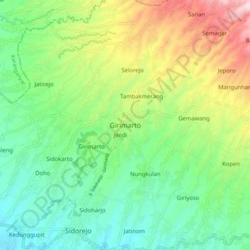
Name: Girimarto topographic map, elevation, terrain.
Location: Girimarto, Wonogiri, Central Java, Java, 57683, Indonesia (-7.83018 111.04261 -7.75018 111.12261)
Average elevation: 455 m
Minimum elevation: 285 m
Maximum elevation: 790 m
Thank you for supporting this site ❤️
Make a donation
Make a donation
Gear up for your next adventure:
As an Amazon Associate, this site earns from qualifying purchases at no extra cost to you.