
Thank you for supporting this site ❤️
Make a donation
Make a donation
Gear up for your next adventure:
As an Amazon Associate, this site earns from qualifying purchases at no extra cost to you.
Hacıömer topographic map
Click on the map to display elevation.
Thank you for supporting this site ❤️
Make a donation
Make a donation
Gear up for your next adventure:
As an Amazon Associate, this site earns from qualifying purchases at no extra cost to you.
About this map
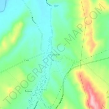
Name: Hacıömer topographic map, elevation, terrain.
Location: Hacıömer, Tekman, Erzurum, Eastern Anatolia Region, Turkey (39.58278 41.73551 39.62278 41.77551)
Average elevation: 1,874 m
Minimum elevation: 1,800 m
Maximum elevation: 2,026 m
Thank you for supporting this site ❤️
Make a donation
Make a donation
Gear up for your next adventure:
As an Amazon Associate, this site earns from qualifying purchases at no extra cost to you.