Geolocate

Lacombe topographic map

Click on the map to display elevation.

About this map

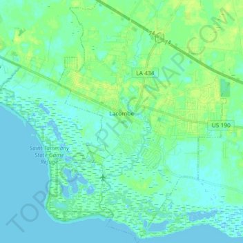
Name: Lacombe topographic map, elevation, terrain.

Location: Lacombe, St. Tammany Parish, Louisiana, 70445, United States (30.24687 -89.98087 30.37158 -89.87620)

Average elevation: 4 m

Minimum elevation: -3 m

Maximum elevation: 11 m

Gear up for your next adventure:

🕶️Polarized Sunglasses - Protect your eyes with durable polarized lenses
🛶Kayak Accessories - Essential gear for safe and fun kayaking adventures
🧰Multitool Knife - Compact and versatile tool for outdoor use
🥫Freeze-Dried Meals - Lightweight, high-calorie nutrition for multi-day treks
💧Reusable Water Bottle - Durable water bottles for hydration on trails

As an Amazon Associate, this site earns from qualifying purchases at no extra cost to you.