Geolocate

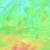
Saint-Maur topographic map

Click on the map to display elevation.

About this map

Name: Saint-Maur topographic map, elevation, terrain.

Location: Saint-Maur, Châteauroux, Indre, Centre-Val de Loire, France métropolitaine, 36250, France (46.73659 1.55593 46.85349 1.68455)

Average elevation: 151 m

Minimum elevation: 121 m

Maximum elevation: 192 m

Other topographic maps

Click on a map to view its topography, its elevation and its terrain.
La Farge

France > Centre-Val de Loire > Indre > Saint-Maur

Average elevation: 163 m

Gear up for your next adventure:

👟Sport Hiking Sandals - Breathable footwear for water crossings and camp rest
🧰Multitool Knife - Compact and versatile tool for outdoor use
🔪Outdoor Multitool - Versatile tool for repairs and food prep in the wild
🧣Evaporative Cooling Towel - Beat the heat during intense summer climbs
👟Trail Running Shoes - Agile footwear for fast-paced topographic exploration

As an Amazon Associate, this site earns from qualifying purchases at no extra cost to you.