Geolocate

Alto topographic map

Click on the map to display elevation.

About this map

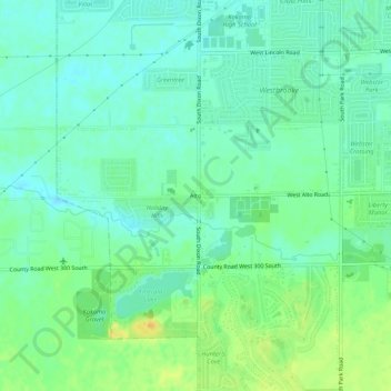
Name: Alto topographic map, elevation, terrain.

Location: Alto, Kokomo, Howard County, Indiana, 46902, United States (40.42004 -86.18555 40.46004 -86.14555)

Average elevation: 256 m

Minimum elevation: 246 m

Maximum elevation: 274 m

Gear up for your next adventure:

🧰Emergency Multi-Tool - Compact multi-tool for outdoor survival
🧰Survival Kit - Essential gear for emergencies in the wilderness
👟Trail Running Shoes - Agile footwear for fast-paced topographic exploration
🧴Outdoor Sunscreen - High SPF protection for high-altitude UV exposure
🔋Emergency Crank Radio - Weather alerts and power without needing batteries

As an Amazon Associate, this site earns from qualifying purchases at no extra cost to you.