Geolocate

Montefiorello topographic map

Click on the map to display elevation.

About this map

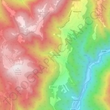
Name: Montefiorello topographic map, elevation, terrain.

Location: Montefiorello, Vallo di Nera, Perugia, Umbria, 06040, Italy (42.76580 12.83248 42.80580 12.87248)

Average elevation: 812 m

Minimum elevation: 310 m

Maximum elevation: 1,212 m

Gear up for your next adventure:

🪜Heavy Duty Carabiners - Multi-use clips for securing gear to your backpack
🛌Down Sleeping Bag - Superior warmth-to-weight ratio for cold nights
Camping Essentials - All-in-one gear for a comfortable camping trip
🥾Waterproof Trail Shoes - Shoes designed to handle wet terrain
🔋Lithium AA Batteries - Long-lasting power that performs in extreme cold

As an Amazon Associate, this site earns from qualifying purchases at no extra cost to you.