Geolocate

Ngapa topographic map

Click on the map to display elevation.

About this map

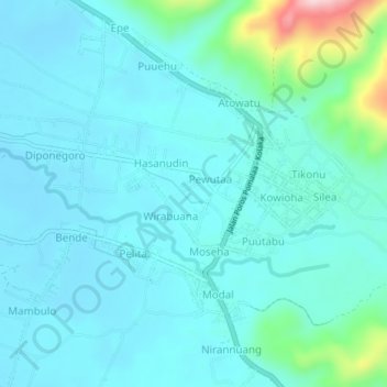
Name: Ngapa topographic map, elevation, terrain.

Location: Ngapa, Kolaka, Southeast Sulawesi, Sulawesi, Indonesia (-4.13720 121.65070 -4.09720 121.69070)

Average elevation: 41 m

Minimum elevation: 2 m

Maximum elevation: 265 m

Gear up for your next adventure:

🧰Emergency Multi-Tool - Compact multi-tool for outdoor survival
🧼Biodegradable Camp Soap - Environmentally friendly cleaning for gear and body
🪑Insulated Seat Pad - Protect your seat from cold rocks and wet logs
🥤Collapsible Travel Cup - Saves space and weight in your mess kit
Lightweight Camping Tent - Portable shelter optimized for Canadian backcountry camping

As an Amazon Associate, this site earns from qualifying purchases at no extra cost to you.