Geolocate

Bukit Pinang topographic map

Click on the map to display elevation.

About this map

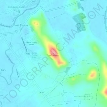
Name: Bukit Pinang topographic map, elevation, terrain.

Location: Bukit Pinang, Kota Setar, Kedah, 06200, Malaysia (6.19409 100.43682 6.19419 100.43692)

Average elevation: 19 m

Minimum elevation: 2 m

Maximum elevation: 111 m

Gear up for your next adventure:

💡LED Headlamp - Hands-free illumination for night hiking and camping
🧢Hiking Sun Hat - Wide-brimmed protection for exposed mountain ridges
Camping Groundsheet - Protect your tent from moisture and dirt
💡Portable Camping Lamp - Rechargeable lamp for campsite lighting
🧢Outdoor Visor - Breathable visor for sunny hikes

As an Amazon Associate, this site earns from qualifying purchases at no extra cost to you.