
Thank you for supporting this site ❤️
Make a donation
Make a donation
Gear up for your next adventure:
As an Amazon Associate, this site earns from qualifying purchases at no extra cost to you.
Colmenar topographic map
Click on the map to display elevation.
Thank you for supporting this site ❤️
Make a donation
Make a donation
Gear up for your next adventure:
As an Amazon Associate, this site earns from qualifying purchases at no extra cost to you.
About this map
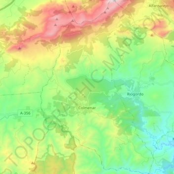
Name: Colmenar topographic map, elevation, terrain.
Location: Colmenar, La Axarquía, Malaga, Andalusia, 29170, Spain (36.85779 -4.37882 36.98279 -4.27680)
Average elevation: 722 m
Minimum elevation: 232 m
Maximum elevation: 1,616 m
Thank you for supporting this site ❤️
Make a donation
Make a donation
Gear up for your next adventure:
As an Amazon Associate, this site earns from qualifying purchases at no extra cost to you.