
Győrszemere topographic map
Interactive map
Click on the map to display elevation.
About this map
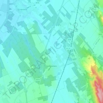
Name: Győrszemere topographic map, elevation, terrain.
Average elevation: 131 m
Minimum elevation: 109 m
Maximum elevation: 264 m
Other topographic maps
Click on a map to view its topography, its elevation and its terrain.
Sarród
Hongrie > Győr-Moson-Sopron vármegye
Sarród, Soproni járás, Győr-Moson-Sopron vármegye, Transdanubie occidentale, Transdanubie, Hongrie
Average elevation: 116 m