
Canaima topographic map
Interactive map
Click on the map to display elevation.
About this map
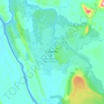
Name: Canaima topographic map, elevation, terrain.
Average elevation: 450 m
Minimum elevation: 343 m
Maximum elevation: 1,195 m
Other topographic maps
Click on a map to view its topography, its elevation and its terrain.
Auyan-Tepui
Venezuela > Bolívar > Municipio Gran Sabana
Auyan-Tepui, Municipio Gran Sabana, Bolívar, Venezuela
Average elevation: 1,203 m
La Gran Sabana
Venezuela > Bolívar > Municipio Gran Sabana
La Gran Sabana, Parroquia Gran Sabana, Municipio Gran Sabana, Bolívar, Venezuela
Average elevation: 862 m
Parroquia Gran Sabana
Venezuela > Bolívar > Municipio Gran Sabana
Parroquia Gran Sabana, Municipio Gran Sabana, Bolívar, 8011, Venezuela
Average elevation: 756 m