Geolocate

Omao topographic map

Click on the map to display elevation.

About this map

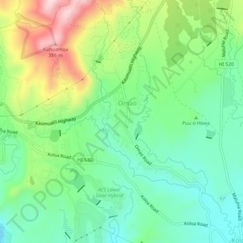
Name: Omao topographic map, elevation, terrain.

Location: Omao, Kauaʻi County, Hawaii, United States (21.90376 -159.49257 21.94283 -159.46645)

Average elevation: 159 m

Minimum elevation: 40 m

Maximum elevation: 389 m

Gear up for your next adventure:

🔨Vehicle Emergency Tool - Safety tool for remote road trips to trailheads
🧊Insulated Water Bottle - Keeps drinks cold in summer and prevents freezing in winter
🧴Sunscreen SPF - Broad-spectrum sunscreen for outdoor activities
🧦Hiking Socks - Moisture-wicking and comfortable socks for long hikes
🦌Outdoor Trail Camera - Monitor wildlife activity near your favorite spots

As an Amazon Associate, this site earns from qualifying purchases at no extra cost to you.