Geolocate

Sevoke topographic map

Click on the map to display elevation.

About this map

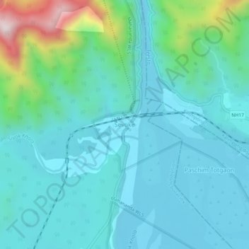
Name: Sevoke topographic map, elevation, terrain.

Location: Sevoke, Kurseong Subdivision, Darjeeling, West Bengal, India (26.85972 88.45080 26.89972 88.49080)

Average elevation: 254 m

Minimum elevation: 130 m

Maximum elevation: 836 m

Gear up for your next adventure:

Lightweight Backpacking Tent - Compact tent for efficient hiking trips
🚲MTB Frame Bag - Carry tools and maps directly on your bicycle frame
Camping Tent - Weather-resistant tents suitable for 2 to 6 people
💡Portable Camping Lamp - Rechargeable lamp for campsite lighting
🎒Backpack Rain Cover - External shield to keep your entire pack dry

As an Amazon Associate, this site earns from qualifying purchases at no extra cost to you.