Geolocate

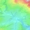
Le Terreau topographic map

Click on the map to display elevation.

About this map

Name: Le Terreau topographic map, elevation, terrain.

Location: Le Terreau, Novalaise, Chambéry, Savoie, Auvergne-Rhône-Alpes, France métropolitaine, 73470, France (45.55269 5.76593 45.59269 5.80593)

Average elevation: 480 m

Minimum elevation: 373 m

Maximum elevation: 1,097 m

Other topographic maps

Click on a map to view its topography, its elevation and its terrain.
73470

France > Auvergne-Rhône-Alpes > Savoie > Novalaise > Carabin

Average elevation: 491 m

Gear up for your next adventure:

🧥Ultralight Puffy Jacket - Maximum warmth that packs down to the size of an orange
🛶Kayak Dry Bag - Waterproof storage for kayaking adventures
🧥Thermal Layer - Insulating layer for cold outdoor conditions
🍽️Titanium Camping Spork - Ultralight and indestructible eating utensil
🚑Survival Whistle - Signal for help across long distances in mountains

As an Amazon Associate, this site earns from qualifying purchases at no extra cost to you.