
Thank you for supporting this site ❤️
Make a donation
Make a donation
Gear up for your next adventure:
As an Amazon Associate, this site earns from qualifying purchases at no extra cost to you.
Mandasco topographic map
Click on the map to display elevation.
Thank you for supporting this site ❤️
Make a donation
Make a donation
Gear up for your next adventure:
As an Amazon Associate, this site earns from qualifying purchases at no extra cost to you.
About this map
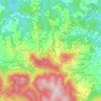
Name: Mandasco topographic map, elevation, terrain.
Location: Mandasco, Calghera, Colli Verdi, Pavia, Lombardia, 27059, Italia (44.85339 9.19675 44.89339 9.23675)
Average elevation: 595 m
Minimum elevation: 397 m
Maximum elevation: 859 m
Thank you for supporting this site ❤️
Make a donation
Make a donation
Gear up for your next adventure:
As an Amazon Associate, this site earns from qualifying purchases at no extra cost to you.