Geolocate

Guerrero topographic map

Click on the map to display elevation.

About this map

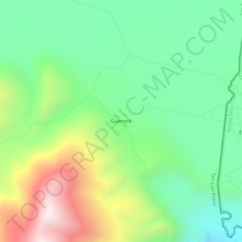
Name: Guerrero topographic map, elevation, terrain.

Location: Guerrero, San Ciro de Acosta, San Luis Potosí, Mexico (21.53468 -99.78995 21.57468 -99.74995)

Average elevation: 1,140 m

Minimum elevation: 799 m

Maximum elevation: 1,778 m

Gear up for your next adventure:

🧣Merino Neck Gaiter - Protects against wind, sun, and cold at high altitudes
Backpacking Tent - Lightweight tent for long-distance hiking trips
🕶️Polarized Sunglasses - Reduces glare from snow and water at high elevations
🧭GPS Outdoor Watch - Smart watch for navigation and fitness tracking in nature
Camping Tent - Weather-resistant tents suitable for 2 to 6 people

As an Amazon Associate, this site earns from qualifying purchases at no extra cost to you.