Geolocate

Mambalili topographic map

Click on the map to display elevation.

About this map

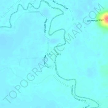
Name: Mambalili topographic map, elevation, terrain.

Location: Mambalili, Bunawan, Agusan del Sur, Caraga, 8506, Philippines (8.17796 125.95025 8.21796 125.99025)

Average elevation: 21 m

Minimum elevation: 16 m

Maximum elevation: 77 m

Gear up for your next adventure:

🧥Thermal Layer - Insulating layer for cold outdoor conditions
🔪Outdoor Multitool - Versatile tool for repairs and food prep in the wild
🥾Hiking Shorts - Breathable shorts suitable for summer hikes
🧢Sun Hat - Wide-brim hat for sun protection
🧢Outdoor Visor - Breathable visor for sunny hikes

As an Amazon Associate, this site earns from qualifying purchases at no extra cost to you.