Geolocate

Padara topographic map

Click on the map to display elevation.

About this map

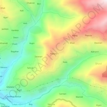
Name: Padara topographic map, elevation, terrain.

Location: Padara, Kotkhai, Shimla, Himachal Pradesh, 171204, India (31.11452 77.55041 31.15452 77.59041)

Average elevation: 2,105 m

Minimum elevation: 1,654 m

Maximum elevation: 2,731 m

Gear up for your next adventure:

🧢Hiking Hat - Sun-protective and breathable hats for long treks
🎒Hiking Daypack - Lightweight and durable backpacks for day trips and excursions
🧼Biodegradable Camp Soap - Environmentally friendly cleaning for gear and body
🔦UV Flashlight - Detect minerals or specific insects in the dark
💡Compact LED Flashlight - Powerful and portable flashlight for outdoor use

As an Amazon Associate, this site earns from qualifying purchases at no extra cost to you.