Geolocate

Bellavista topographic map

Click on the map to display elevation.

About this map

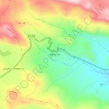
Name: Bellavista topographic map, elevation, terrain.

Location: Bellavista, Namora, Cajamarca, Perú (-7.21288 -78.37559 -7.17288 -78.33559)

Average elevation: 2,960 m

Minimum elevation: 2,752 m

Maximum elevation: 3,215 m

Gear up for your next adventure:

🧢Hiking Hat - Sun-protective and breathable hats for long treks
🩹Moleskin Blister Pads - Direct protection for painful foot pressure points
🗺️Topographic Maps - Detailed maps to explore trails, mountains, and wilderness areas
Family Camping Tent - Spacious tent suitable for family camping trips
🥾Hiking Gaiters - Protect legs and shoes from mud, snow, and debris

As an Amazon Associate, this site earns from qualifying purchases at no extra cost to you.