Geolocate

Ayers topographic map

Click on the map to display elevation.

About this map

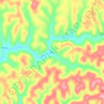
Name: Ayers topographic map, elevation, terrain.

Location: Ayers, Calhoun County, West Virginia, 26136, United States (38.95814 -81.11845 38.99814 -81.07845)

Average elevation: 289 m

Minimum elevation: 210 m

Maximum elevation: 360 m

Other topographic maps

Click on a map to view its topography, its elevation and its terrain.

Gear up for your next adventure:

🛶Waterproof Dry Bags - Keep electronics and clothes dry during river crossings
🧊Portable Cooler - Keep food and drinks cold during outdoor adventures
🔭Outdoor Binoculars - Lightweight binoculars for birdwatching and hiking
🥾Mountaineering Boots - Supportive boots for climbing and high-altitude hiking
🚲Handlebar Phone Mount - View topographic-map.com live while cycling

As an Amazon Associate, this site earns from qualifying purchases at no extra cost to you.