
Roussillon topographic map
Click on the map to display elevation.
About this map
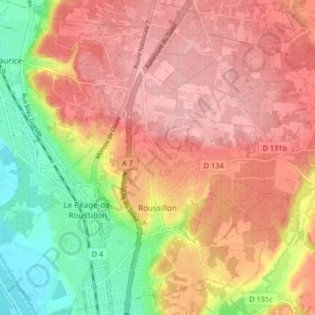
Name: Roussillon topographic map, elevation, terrain.
Average elevation: 213 m
Minimum elevation: 135 m
Maximum elevation: 264 m
Other topographic maps
Click on a map to view its topography, its elevation and its terrain.
Lac de Paladru
France > Auvergne-Rhône-Alpes > Isère > Paladru
The lake area has a cool temperate climate. The north–south orientation and relatively high altitude means the average temperature is around 10 °C. Rainfall is irregular, with most rain occurring in June and October with the rise of humid air masses from the Mediterranean. January is the coldest month, with…
Average elevation: 569 m
Les Brunières
France > Auvergne-Rhône-Alpes > Isère > Saint-Quentin-sur-Isère
Average elevation: 423 m
Roche Béranger
France > Auvergne-Rhône-Alpes > Isère > Chamrousse
The road to the ski station starts at Uriage-les-Bains from where the climb is 19 km (12 mi) long, gaining 1,235 m (4,052 ft) in elevation, at an average gradient of 6.5%. There are several sections in excess off 11% in the early stages of the climb. For the Tour de France, the summit is at an elevation of…
Average elevation: 1,561 m
Uriage Les Bains
France > Auvergne-Rhône-Alpes > Isère > Saint-Martin-d'Uriage
Average elevation: 618 m
Hameau des Farlaix
France > Auvergne-Rhône-Alpes > Isère > Autrans-Méaudre en Vercors > Méaudre
Average elevation: 1,155 m