Geolocate

Corps topographic map

Click on the map to display elevation.

About this map

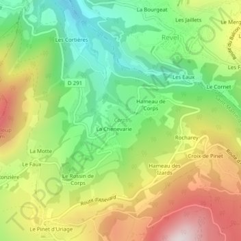
Name: Corps topographic map, elevation, terrain.

Location: Corps, Saint-Martin-d'Uriage, Grenoble, Isère, Auvergne-Rhône-Alpes, Metropolitan France, 38410, France (45.17316 5.85581 45.17958 5.86897)

Average elevation: 721 m

Minimum elevation: 429 m

Maximum elevation: 1,104 m

Other topographic maps

Click on a map to view its topography, its elevation and its terrain.

Gear up for your next adventure:

🧢Outdoor Visor - Breathable visor for sunny hikes
🥾Trail Running Shoes - Lightweight and durable shoes for trail running
🦟Insect Repellent - Keep mosquitoes and black flies away in wooded areas
🧥Softshell Jacket - Windproof and breathable jacket for hiking
💡Solar Camping Lamp - Eco-friendly lighting for campsites

As an Amazon Associate, this site earns from qualifying purchases at no extra cost to you.