
Thank you for supporting this site ❤️
Make a donation
Make a donation
Gear up for your next adventure:
As an Amazon Associate, this site earns from qualifying purchases at no extra cost to you.
Duvernay topographic map
Click on the map to display elevation.
Thank you for supporting this site ❤️
Make a donation
Make a donation
Gear up for your next adventure:
As an Amazon Associate, this site earns from qualifying purchases at no extra cost to you.
About this map
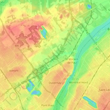
Name: Duvernay topographic map, elevation, terrain.
Location: Duvernay, Laval (administrative region), Quebec, Canada (45.56720 -73.72432 45.67312 -73.58000)
Average elevation: 34 m
Minimum elevation: -20 m
Maximum elevation: 64 m
Thank you for supporting this site ❤️
Make a donation
Make a donation
Gear up for your next adventure:
As an Amazon Associate, this site earns from qualifying purchases at no extra cost to you.