Geolocate

El Verano topographic map

Click on the map to display elevation.

About this map

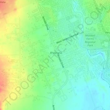
Name: El Verano topographic map, elevation, terrain.

Location: El Verano, Sonoma County, California, United States (38.28699 -122.50303 38.30729 -122.47637)

Average elevation: 40 m

Minimum elevation: 20 m

Maximum elevation: 72 m

Gear up for your next adventure:

🚲Bike Repair Kit - Essential tools for on-trail mechanical issues
🔋Lithium AA Batteries - Long-lasting power that performs in extreme cold
🧦Outdoor Socks - Durable socks designed for hiking and outdoor sports
🎒Backpack Rain Cover - External shield to keep your entire pack dry
🥾Durable Hiking Shoes - Long-lasting shoes for frequent hiking

As an Amazon Associate, this site earns from qualifying purchases at no extra cost to you.