Geolocate

Mimberg topographic map

Click on the map to display elevation.

About this map

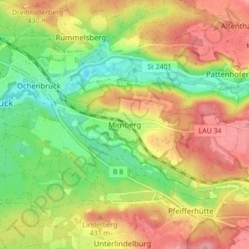
Name: Mimberg topographic map, elevation, terrain.

Location: Mimberg, Burgthann, Landkreis Nürnberger Land, Bayern, 90592, Deutschland (49.33194 11.25717 49.37194 11.29717)

Average elevation: 395 m

Minimum elevation: 343 m

Maximum elevation: 447 m

Other topographic maps

Click on a map to view its topography, its elevation and its terrain.

Gear up for your next adventure:

🪑Ultralight Camping Stool - Compact seating for rest stops during long hikes
🎒Hiking Backpack - Lightweight and ergonomic backpacks for day hikes or multi-day treks
🥾Waterproof Trail Shoes - Shoes designed to handle wet terrain
🔦LED Headlamp - Hands-free lighting for early morning starts or late finishes
Camping Tent - Weather-resistant tents suitable for 2 to 6 people

As an Amazon Associate, this site earns from qualifying purchases at no extra cost to you.