Geolocate

Vechur topographic map

Click on the map to display elevation.

About this map

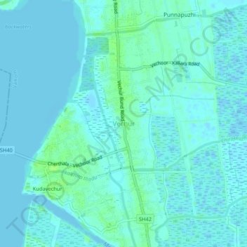
Name: Vechur topographic map, elevation, terrain.

Location: Vechur, Vaikom, Kottayam, Kerala, 686144, India (9.65794 76.40089 9.69794 76.44089)

Average elevation: 3 m

Minimum elevation: -2 m

Maximum elevation: 10 m

Other topographic maps

Click on a map to view its topography, its elevation and its terrain.

Dr. Ambedkar

India > Kerala > Vaikom > Arayankavu

Average elevation: 13 m

Muvatupuzha

India > Kerala > Vaikom > Velloor

Average elevation: 14 m

Omalloor

India > Kerala > Vaikom > Manjoor

Average elevation: 30 m

Mulakulam

India > Kerala > Vaikom

Average elevation: 15 m

Mundar

India > Kerala > Vaikom > Kallara

Average elevation: 1 m

Gear up for your next adventure:

🧢Sun Hat - Wide-brim hat for sun protection
🥾Light Hiking Boots - Lightweight and comfortable boots for day hikes
🛶Canoe Life Vest - Safety vest for water sports
🥾Waterproof Hiking Shoes - Durable shoes for wet and rugged trails
🧢Beanie Hat - Keep your head warm in cold weather

As an Amazon Associate, this site earns from qualifying purchases at no extra cost to you.