Geolocate

Rancatama topographic map

Click on the map to display elevation.

About this map

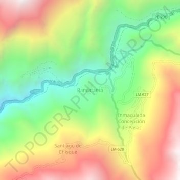
Name: Rancatama topographic map, elevation, terrain.

Location: Rancatama, Atavillos Alto, Huaral, Lima, Perú (-11.26409 -76.70303 -11.22409 -76.66303)

Average elevation: 3,019 m

Minimum elevation: 2,305 m

Maximum elevation: 3,858 m

Gear up for your next adventure:

🥾Mountaineering Boots - Supportive boots for climbing and high-altitude hiking
🧢Hiking Hat - Sun-protective and breathable hats for long treks
🧦Hiking Liner Socks - Thin base layer to prevent friction and blisters
🥾Mountain Hiking Boots - High-traction boots for rocky terrain
🎒Hiking Backpack - Lightweight and ergonomic backpacks for day hikes or multi-day treks

As an Amazon Associate, this site earns from qualifying purchases at no extra cost to you.