Geolocate

Lala topographic map

Click on the map to display elevation.

About this map

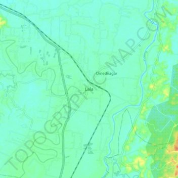
Name: Lala topographic map, elevation, terrain.

Location: Lala, Hailakandi district, Assam, India (24.51999 92.56783 24.59999 92.64783)

Average elevation: 30 m

Minimum elevation: 20 m

Maximum elevation: 64 m

Gear up for your next adventure:

🧊Portable Cooler - Keep food and drinks cold during outdoor adventures
🎒Hiking Backpack - Lightweight and ergonomic backpacks for day hikes or multi-day treks
🔦UV Flashlight - Detect minerals or specific insects in the dark
👖Convertible Hiking Pants - Zip-off legs to adapt to changing weather conditions
🧢Outdoor Cap - Protective cap for sun and rain during hikes

As an Amazon Associate, this site earns from qualifying purchases at no extra cost to you.