Geolocate

Mauku topographic map

Click on the map to display elevation.

About this map

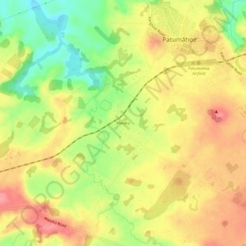
Name: Mauku topographic map, elevation, terrain.

Location: Mauku, Patumāhoe, Franklin, Auckland, 2678, New Zealand (-37.22133 174.79667 -37.18133 174.83667)

Average elevation: 60 m

Minimum elevation: 7 m

Maximum elevation: 101 m

Gear up for your next adventure:

🥾Light Trekking Boots - Supportive boots for multi-day treks
🔭Compact Binoculars - Lightweight optics for scouting trails and wildlife
🚲MTB Frame Bag - Carry tools and maps directly on your bicycle frame
🔥Emergency Fire Starter - Reliable ignition source for all weather conditions
🛌Down Sleeping Bag - Superior warmth-to-weight ratio for cold nights

As an Amazon Associate, this site earns from qualifying purchases at no extra cost to you.