Geolocate

Lozaphohemi topographic map

Click on the map to display elevation.

About this map

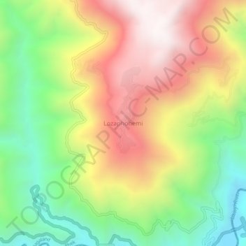
Name: Lozaphohemi topographic map, elevation, terrain.

Location: Lozaphohemi, Phek Sadar, Phek, Nagaland, India (25.61482 94.46644 25.65482 94.50644)

Average elevation: 1,230 m

Minimum elevation: 673 m

Maximum elevation: 1,851 m

Gear up for your next adventure:

🧊Insulated Water Bottle - Keeps drinks cold in summer and prevents freezing in winter
🧥Waterproof Jacket - Lightweight rain jackets for hiking and outdoor activities
🔨Vehicle Emergency Tool - Safety tool for remote road trips to trailheads
🧊Portable Cooler - Keep food and drinks cold during outdoor adventures
🥾Mountain Hiking Shoes - Shoes with superior grip for mountainous terrain

As an Amazon Associate, this site earns from qualifying purchases at no extra cost to you.