Geolocate

Rexburg topographic map

Click on the map to display elevation.

About this map

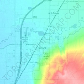
Name: Rexburg topographic map, elevation, terrain.

Location: Rexburg, Madison County, Idaho, 83460, United States (43.79356 -111.83788 43.86297 -111.74794)

Average elevation: 1,504 m

Minimum elevation: 1,476 m

Maximum elevation: 1,607 m

Gear up for your next adventure:

🧤Rechargeable Heated Gloves - Extreme warmth for Canadian winter expeditions
🩹Compact First Aid Kit - Pre-packed essentials for common trail injuries
🥾Mountain Trail Shoes - High-traction shoes for mountain trails
🥾Hiking Leggings - Comfortable leggings for outdoor activities
🔋Emergency Crank Radio - Weather alerts and power without needing batteries

As an Amazon Associate, this site earns from qualifying purchases at no extra cost to you.